Original Map of Jamaica Village Long Island
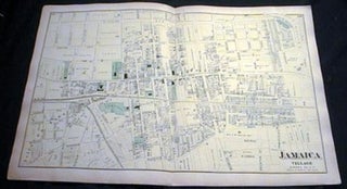
New York: Beers, 1873. Original Hand-colored Map of Jamaica Village, from Beers' Atlas of Long Island, 18 1/2" x 23 " approximate size; somewhat age-toned, old fold-lines; very good condition.
New York: Beers, 1873. Original Hand-colored Map of Jamaica Village, from Beers' Atlas of Long Island, 18 1/2" x 23 " approximate size; somewhat age-toned, old fold-lines; very good condition.
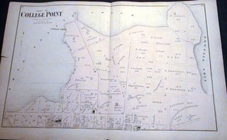
New York: Beers, 1873. Original Hand-colored Map of Part of College Point Town of Flushing (Northern Part), from Beers' Atlas of Long Island, 15 1/2" x 23 " approximate size; somewhat age-toned; very good condition.
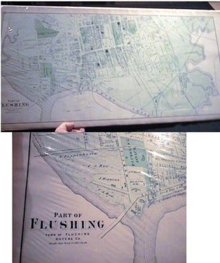
New York: Beers, 1873. Original Hand-colored Map of Part of Flushing, with Flushing Creek, from Beers' Atlas of Long Island, three section folding, 15 1/2" x 32 " approximate size; somewhat age-toned; very good condition.
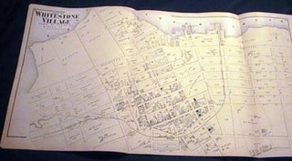
New York: Beers, 1873. Original Hand-colored Map of Part of Whitestone Village (Northern Part) from Beers' Atlas of Long Island, three section folding, 15 1/2" x 30 " approximate size; somewhat age-toned; very good condition.
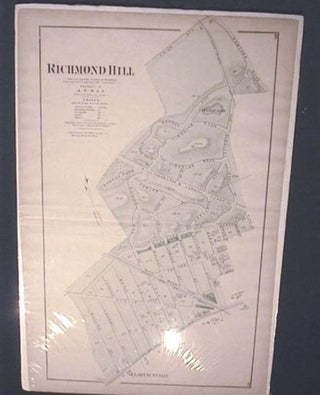
New York: Beers, 1873. Original Hand-colored Map of Richmond Hill, from Beers' Atlas of Long Island, 15 1/2" x 23 " approximate size; light edge-wear; age-toned, old fold-lines, some off-setting; very good condition.