
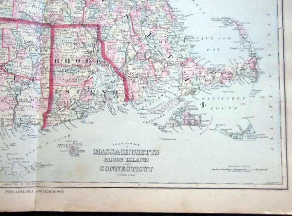
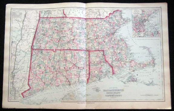
Original Double-Page Hand-Colored Gray's New Map of Massachusetts Rhode Island and Connecticut By Frank A. Gray
Philadelphia, PA: O.W. Gray & Son, 1882. F. One sheet, from the 1882 O.W. Gray National Atlas, New York Edition: Double-page map of Massachusetts Rhode Island and Connecticut, with small inset map of Environs of Boston. Copyright of 1876, engraved by J.M. Atwood. With original hand-coloring in pastel tones, border outlining in red. Approx. 28 1/2" x 17 1/4" overall size; a little even toning to the paper, top corner with tiny chip, a little soiling at bottom edge; in very good condition. Item #25051
Price: $65.00