Map of South America
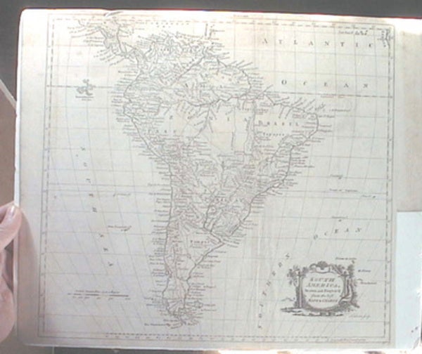
London & Edinburgh: Harvey's Naval History, 1780. Single-side printed map or chart; engraved; depicts "South America, Drawn and Engrav'd from the best Maps & Charts" in a small cartouche to the bottom right; no date but 1780; "Engraved for Harvey's Naval History" at top; depicts Galapagos Islands, Amazonia, Terra Firma, New Granada, Plain Land, forts, rivers, more; 13 3/4" x 15 1/2" approximate size; slim margins; shrink-wrapped to archival foam core for protection and shipping; some light offsetting, toning, dustiness, one closed 1/16" hole, unobtrusive; good condition; an interesting map. Item #7905
Price: $85.00
See all items by Map of South America